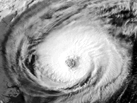
Hurricane Emily off Cape Hatteras, NC.

Hurricane Emily off Cape Hatteras, NC.
[Text Data]
[Severe Weather]
[Surface Data]
[Upper Air Data]
[Radar Data]
[Satellite Imagery]
[Model Output]
[ Server References]
[ Why these Pages?]
Zeta: got to get a bigger gun, 'cause this season ain't done yet...
| Current Atlantic Hurricane Information | |||
|---|---|---|---|
| Public Forecast & Advisory | |||
| Marine Forecast & Advisory | |||
| Intergovernmental Storm discussion | |||
| Storm Strike Probabilities | |||
| Track Plot | |||
Current GOES 8 Atlantic Visible Image (NOAA)
Current GOES 8 Atlantic Water Vapor Channel Image (NOAA)
Current GOES 8 & 10 Full Disk and Composite Images (NOAA)
Current METEOSAT (E. Atlantic, Africa) Images (NOAA)
Satellite shot of the Atlantic from Africa to Texas from Intellicast.
Arlene,
Bret,
Cindy,
Dennis,
Emily,
Franklin,
Gert,
Harvey,
Irene,
Jose,
Katrina,
Lee,
Maria,
Nate,
Ophelia,
Philippe,
Rita,
Stan,
Tammy,
Vince,
Wilma,
Alpha,
Beta,
Gamma,
Delta,
Espilon,
Alex,
Bonnie,
Charley,
Danielle,
Earl,
Frances,
Gaston,
Hermine,
Ivan,
Ivan II,
Jeanne,
Karl,
Lisa,
Matthew,
Nicole,
Otto,
Paula, Richard,
Shary, Tomas, Virginie, Walter
Ana,
Bill,
Claudette,
Danny,
Erika,
Fabian,
Grace,
Henri,
Isabel,
Juan,
Kate,
Larry,
Mindy,
Nicholas,
Odette, Peter, Rose, Sam,
Teresa, Victor, Wanda
Arthur,
Bertha,
Cristobal,
Dolly,
Edouard,
Fay,
Gustav,
Hanna,
Isidore,
Josephine
,
Kyle,
Lili,
Marco, Nana, Omar,
Paloma, Rene, Sally, Teddy, Vicky, Wilfred
Allison,
Barry,
Chantal,
Dean,
Erin,
Felix,
Gabrielle,
Humberto,
Iris,
Jerry,
Karen,
Lorenzo,
Michelle,
Noel,
Olga,
Pablo, Rebekah,Sebastien, Tanya, Van, Wendy
Alberto,
Beryl,
Chris,
Debby,
Ernesto,
Florence,
Gordon,
Helene,
Isaac,
Joyce,
Keith,
Leslie,
Michael,
Nadine,
Oscar,
Patty,
Rafael,
Sandy,
Tony,
Valerie,
William
Alberto, Beryl, Chris, Debby, Ernesto, Florence, Gordon, Helene,
Isaac, Joyce, Kirk, Leslie, Michael, Nadine, Oscar, Patty, Rafael,
Sandy, Tony, Valerie, William
2004 Storm Names
2003 Storm Names
2002 Storm Names
2001 Storm Names
2000 Storm Names
2006 Storm Names
Interested in the historical
hurricane tracks? Courtesy of NHC,
Dr. Chris Landsea, and Unisys Weather
server.
Atlantic Tropical Weather. That is to say hurricanes (65+ kts), tropical storms (35-64kts), and tropical depressions (20-34 kts and one closed isobar), and easterly waves. Data here is courtesy of Florida State's Meteorology Department, Ohio State's Atmospheric Sciences , and the National Hurricane Center (NHC).
To understand how to decode the Recon Reports, a report by Mike MacDonald.
| Tropical Atlantic Hurricane Information | ||||||||||||||
|---|---|---|---|---|---|---|---|---|---|---|---|---|---|---|
| Discussion | Recon Data | NHC Forecasts (NHC)
|
Tropical weather outlook
|
Coded Recon message
|
Public Forecast & Advisory
|
Tropical weather discussion
|
Coded Recon message
|
Marine Forecast & Advisory
|
Gulf of Mexico
|
Detailed Vortex message
|
Intergovernmental Storm discussion
|
Caribbean Surface Obs
|
Supplemental Vortex message
|
Storm Strike Probabilities
|
|
| Saffir-Simpson Hurricane Strength Scale | |||||
|---|---|---|---|---|---|
| Attribute: | Cat 1 | Cat 2 | Cat 3 | Cat 4 | Cat 5 |
| Wind Speed [kts] | 65-82 | 83-95 | 96-113 | 114-135 | >135 |
| Pressure [mb] | >980 | 965-979 | 945-964 | 920-944 | <919 |
| Layman's terms | A good blow... | Tough storm | Nothing to be triffled with... | Let's see, I've packed the essentials... | Near landfall? Too bad. |

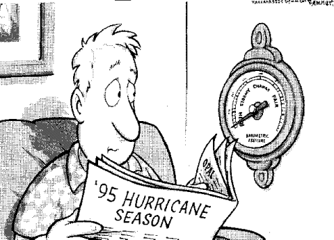
Tallahasee's take on the 1995 hurricane season (Tallahassee Democrat/Clay Bennett). The needle is over "Run". We think there should be another entry after that labled "Pray".
Visible Movie (914 Kb), IR Movie (1639 Kb) and Water Vapour Movie (1774 Kb).